ABOUT KATI THANDA: A Natural Wonder
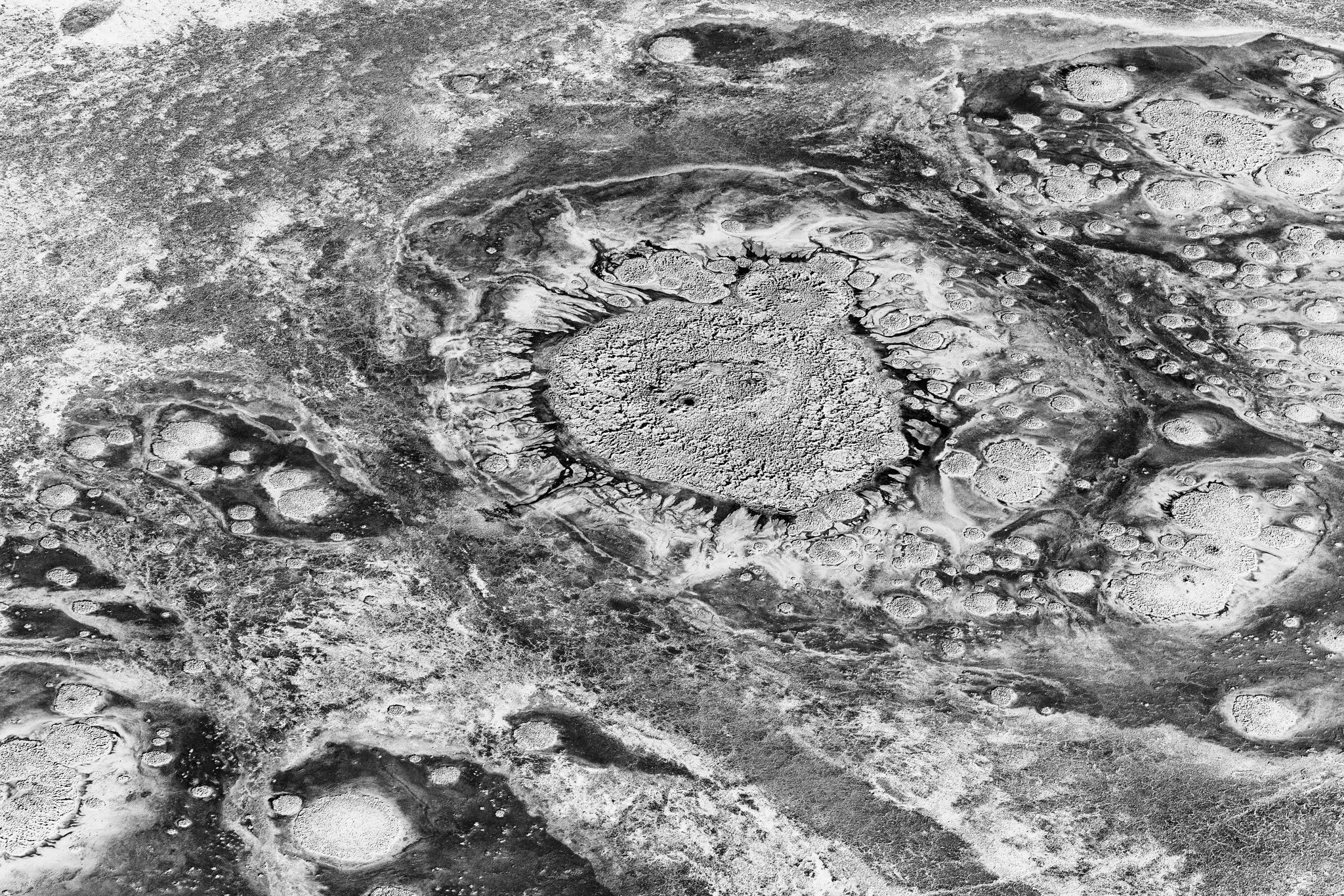
Located 647 kilometers northeast of Adelaide in South Australia, Kati Thanda is Australia's largest salt lake and the continent's lowest point at 15.2 meters below sea level. Covering 9,690 square kilometers, it is the fourth largest terminal lake in the world and contains an estimated 400 million tonnes of salt.
Formed approximately 200 million years ago, this vast salt plain exists in one of Australia's most arid regions, receiving an average annual rainfall of just 140mm against an evaporation rate of 2.5 meters per year. This extreme environment creates a landscape of perpetual change, where salt-crusted plains can transform into immense wetlands after heavy rains.
The lake has filled to capacity only three times in the past 160 years, creating a rare and spectacular natural phenomenon. Even during partial fillings, the lake becomes a crucial breeding ground for waterbirds, with over 80 species recorded in the region, including 17 migratory species.
Cultural Significance
For the Arabana people, the traditional owners of this land, Kati Thanda holds profound cultural significance. Archaeological evidence places Aboriginal occupation of the Lake Eyre Basin at around 40,000 years ago, with the lake playing a central role in many Aboriginal stories and traditions.
In 2012, after a 14-year legal process, the Federal Court recognized the Arabana people as the Traditional Owners of Kati Thanda, granting Native Title rights. Today, Kati Thanda-Lake Eyre National Park is managed in partnership with Arabana and Dieri people to safeguard cultural heritage and conserve this precious natural environment.
The dual naming of "Kati Thanda-Lake Eyre" officially acknowledges the lake's Aboriginal heritage and importance, representing a significant step in recognizing Australia's indigenous cultural landscape.
Ecological Importance
The ecology of Kati Thanda is driven by unpredictable flooding and drying cycles, creating periods of extraordinary productivity followed by scarcity. After heavy rains, salt-crusted plains can transform into an immense wetland teeming with birdlife.
Floods trigger mass breeding of everything from microcrustaceans at the bottom of the food chain to pelicans at the top. During large floods, breeding colonies of Australian pelicans, Silver gulls, and Banded stilts nest on the islands in extraordinary numbers.
After large floods, fish populations can explode, with an estimated forty million fish recorded after the floods of the 1970s. The surrounding area features desert-adapted plants such as mulga, saltbush, spinifex, and Mitchell grass, with river gums and coolibahs along creek lines.
Geographical Context
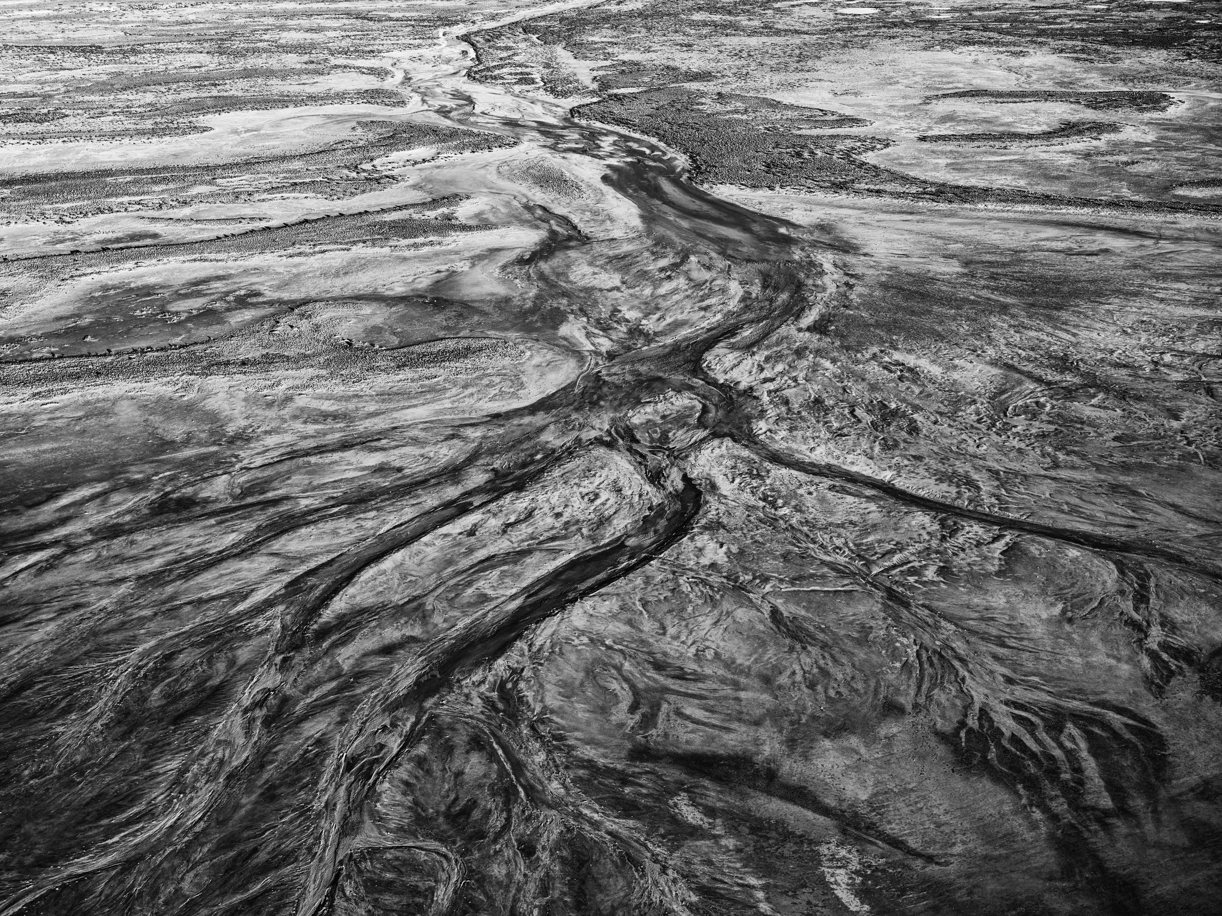
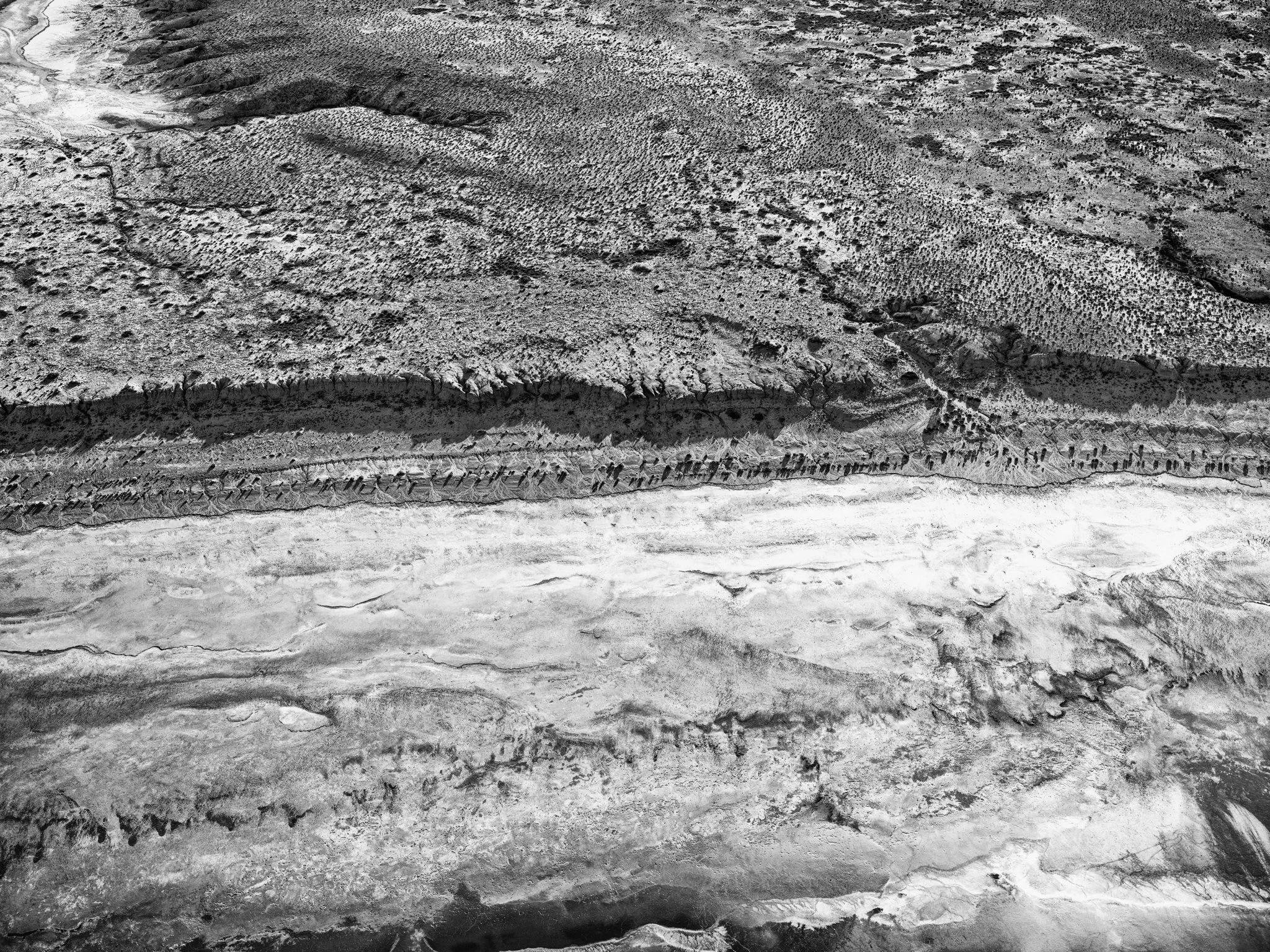
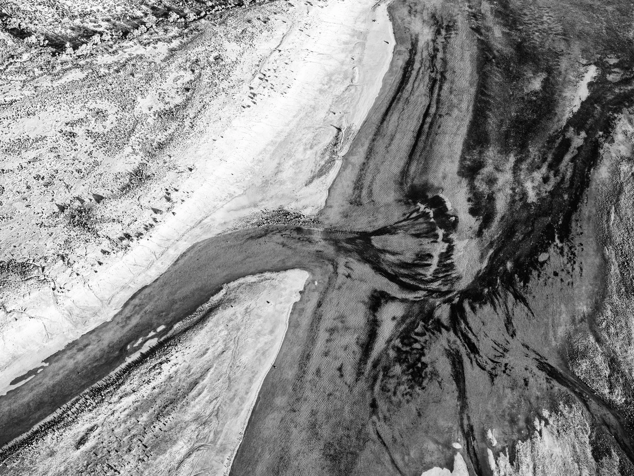
Kati Thanda is part of the Lake Eyre Basin, which covers about 1.2 million square kilometers (almost one-sixth of Australia). The total catchment area is the fourth largest internal system in the world, stretching north past Mount Isa and south to the Flinders Ranges.
The lake is fed by the Diamantina River and Cooper Creek, though most rainfall in the catchment never reaches the lake due to high evaporation rates. Located in the most arid part of Australia, with an average annual rainfall of 140mm and an evaporation rate of 2.5 meters per year, the lake's water levels are in constant flux.
The best time to visit Kati Thanda is between April and October, when temperatures are more moderate. Summer temperatures in the area can soar to more than 50 degrees Celsius, making exploration challenging.
Experience Kati Thanda Through Art
Guy Coburn's fine art photographs offer a unique perspective on this remarkable landscape, capturing its abstract beauty and timeless essence.